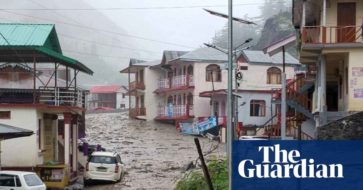
A so-called “cloudburst” has been identified as a potential cause of a river of sludge that swamped a village in northwest India, killing at least four people and leaving 100 more missing.
The Indian Meteorological Department said on Wednesday that over the previous 24 hours extreme rainfall of 210 mm or more had been recorded in parts of northwest India, including the state of Uttarakhand where the disaster happened. Uttarakhand state chief minister Pushkar Singh Dhami said the area had been hit by a “cloudburst” before the deluge of water and debris swamped the village at Dharali.
So what is a cloudburst?
Meteorologists in India define a cloudburst as an event over a concentrated area of 30sqkm or less with rain falling at a rate of 100mm or more per hour. But there are complex processes that can go into these events.
“They usually happen in mountainous regions during monsoons,” said Ruchit Kulkarni, an Indian meteorologist studying extreme rainfall at the University of Melbourne.
He said in the Himalayan foothills, moisture that often comes from the Arabian Sea to the west is swept up by mountains in a process known as orographic lift.
This forms towering cumulonimbus clouds that can sustain large rain droplets.
“So we have this moist airflow being lifted up and the cloud gets bigger and bigger and with no chance to have rainfall, it becomes so heavy that at a point, it starts bursting,” said Kulkarni.
Other factors, such as a bursting of a glacier or glacier lake, could also be behind the flood.
A cloudburst was implicated in one of the nation’s deadliest flood events in June 2013 at Kedarnath, also in Uttarakhand, when according to a UN report more than 6,000 people died.
One study into the Kedarnath floods found more than half of the rainfall was likely linked to increases in greenhouse gases and aerosol particles in the atmosphere.
Studies have found an increase in extreme rainfall events in India in recent decades as global temperatures have risen.