Scientists warn that a popular Hawaiian island is sinking 40 times faster than expected and terrible flooding could start wiping out businesses and homes within decades.
The gorgeous coastal communities on Oahu – including Honolulu, Waikiki, Pearl Harbor and Ewa Beach – will face drastic changes as rising sea levels push them underwater and will cause $12.9 billion in infrastructure costs, a new study found.
Certain areas of Oahu’s South Shore are sinking at a rate of roughly 25mm a year, which is 40 times faster than the gradual sinking rate of the land.
‘In rapidly subsiding areas, sea level rise impacts will be felt much sooner than previously estimated, which means that we must prepare for flooding on a shorter timeline,’ Kyle Murray, a co-author, of the research published in Communications Earth & Environment wrote.
Major tourist area Pearl Harbor and the neighborhood of Mapunapuna could be exposed to flooding within this decade, the study found, which is up to 30 years earlier than expected for Mapunapuna.
However, areas like Downtown Honolulu, the airport, Ewa Beach, and Waikiki will start to really feel the effects by 2080, when it will be ‘exposed to regular flooding.’
By 2080, the projected sea level combined with subsidence – the gradual sinking of land – will be at just under six feet, greatly affecting the coastal regions like Mapunapuna.
By the year 2100, the water levels could be up to eight feet higher, according to the study.


‘Rising sea levels due to climate change are already increasing coastal flood risks in low-lying neighborhoods around Honolulu, and this new study shows that sinking land could significantly amplify those risks,’ Dr. Kristina Dahl, vice president for science at Climate Central, told the DailyMail.com.
‘Add in subsidence rates that are on par with sea level rise rates, and the threat increases substantially.’
By the beginning of the next century, Dahl predicts that ‘higher annual coastal flood levels due to climate-driven sea level rise’ will ‘expose residents, businesses, and infrastructure in parts of Mapunapuna to potential losses.’
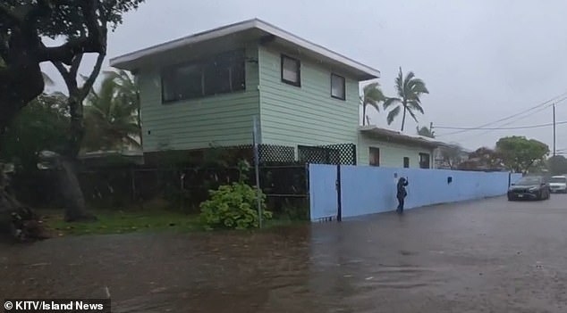
Some areas of the island are already start to see significant flooding during big storms, including just this past January.
Kuliouou, near Honolulu, was deluged in inches of standing water after a torrential downpour.
Every rainy season – which runs from November to March – residents of the area say they deal with flooding, which leads to home and vehicle damage, according to Island News.
‘The second it starts overflooding, then the entire house is gonna have to be cleaned out once the rain’s over,’ resident Kiana Novey noted to the outlet in January.
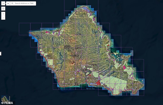
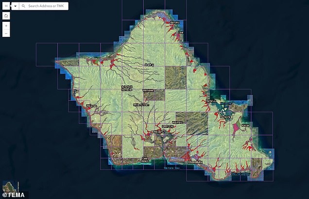
As sea levels continue to rise due to climate change, FEMA has issued a preliminary draft of new flood zones for the island.


Those in designated high-risk flood zones will be required to purchase flood insurance if homeowners have a federally backed loan or mortgage.
Public comment on the proposed new zones, which will drastically change the coverage areas affecting thousands of locals, is open until June 10.
While much of the island was previously not in a flood zone with only Honolulu, Kailua, and a few of the more coastal areas facing deeper threats, now much of the island’s coastline – and the thousands of homes that are situated on it – are under threat of floods.
Co-author of the study, Phil Thompson, said some areas could see a 50 percent increase in flood exposure by 2050, according to the Daily Galaxy.
Risk strategies will have to be implemented to help protect the island, which could eventually mean relocating businesses and homes from high-risk areas.
The only glimmer of hope is that the negative effects of of the sinking start to decrease by 2090 in Mapunapuna, according to the study, but by then, various coastal regions of the island will be -literally and figuratively – under water.